A long weekend and a short road trip around Christchurch
We took advantage of the long weekend around Canterbury Anniversary Day to explore the interior of the country. Hiking, Freedom Camping and three beautiful days are now behind us. Time to tell more about it, because the sites were really beautifully situated. Have fun reading!
Day 1: Christchurch to Harper Camp Site
From Christchurch we headed towards the center of the country. The destination was the Harper Camp Site at Lake Coleridge. Lake Coleridge is a reservoir and is used to generate electricity by Trust Power. The Harper Camp Site is also a small Freedom Camp operated by the energy company.
Situated at the north-western end of Lake Coleridge, the Harper Camp Site is surrounded by several mountains. The only way to reach it is by driving 25 kilometers on a gravel road. But don't worry, the road itself is in good condition and suitable even for larger camper vans or caravans.
We left Christchurch around noon. In Lake Coleridge Village we made a short stop and read the information boards about the hydroelectric power station of Lake Coleridge. There several turbines generate a lot of electricity for the Canterbury region.
Lake Coleridge also has an impressive color and has this great turquoise blue water. Unfortunately, swimming in the lake is not recommended in many places because of the currents and flow speeds of the water.
Nevertheless, it is a great spot.
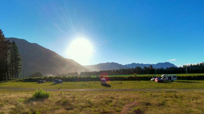
Harper Campsite
The Harper Camp Site
After stopping at Lake Coleridge Village, we took the gravel road to the Harper Camp Site. A long gravel road awaits you, so make sure to fill up your tank and carry enough food and water. You can camp for free for one night at the Harper Camp Site Freedom. If you would like to stay longer than one night, you can request this by e-mail to Trust power. Besides a toilet (bring your own toilet paper) you can go for a walk in the surrounding mountains or to the lakeshore. You can see more in the Google map we have created for you above.
At night you can enjoy a beautiful starry sky here at the Harper Camp Site, because there is no significant light pollution.
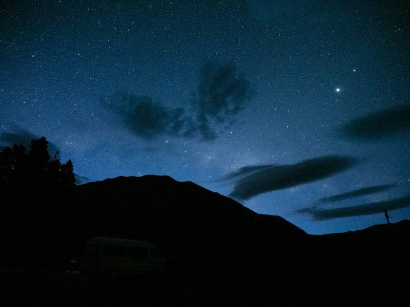
Night sky at the Harper Campsite
Day 2: A hike on Mount Cotton and drive to the Ashburton Lakes
After a relatively windy night, I left early in the morning around 8am to hike on Mount Cotton. Since the summit is 1471m high, you should always pack a rain jacket or other weather protection. I learned my lesson, because while it was windy in the valley and about 20°C, up on the summit it was an unpleasant 5°C felt temperature. So, I was very happy to have a windbreaker with me.
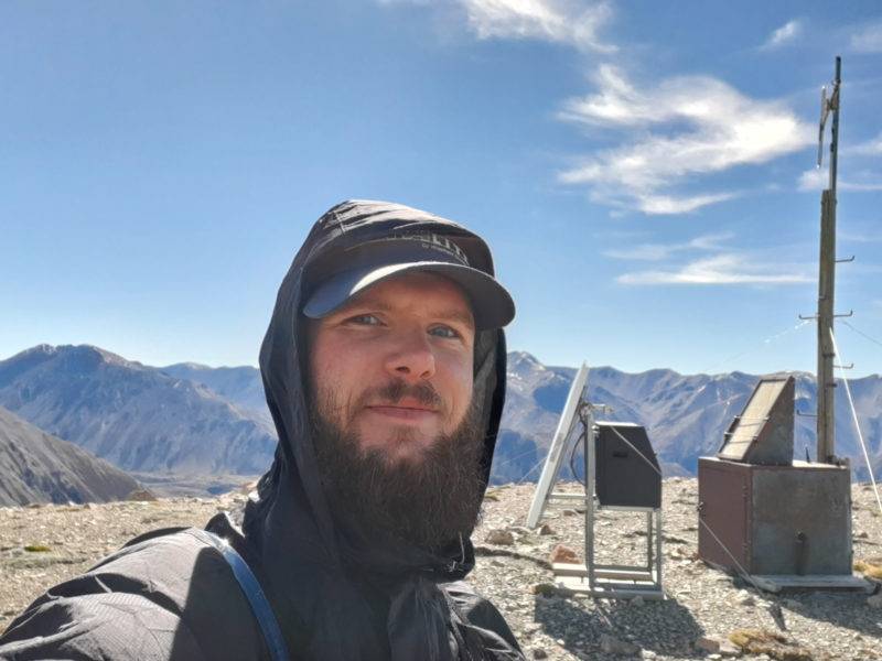
Me at Mount Cotton Summit
Hike from the Harper Camp Site to Mount Cotton and back
Important notice (thanks Griffyth): Mount Cotton & surrounding summits lies on private high-country station land. Please seek permission before attempting or doing the hike. Depending on the time of the year access might be forbidden due to lambing or other farm activies.
The total walk from the Harper Camp site to Mount Cotton summit and back is about 16 kilometers. You will walk up about 1000 meters of altitude and on the way back down again. According to Komoot the whole distance takes 5-6 hours if you walk at a relaxed pace. I was a bit faster because I jogged a lot (especially down the mountain) and therefore it took me only 3.5 hours for the whole distance. But please don't take that as a yardstick, I was alone and didn't take any breaks.
Most of the time the hiking trail is an old four-wheel drive path and therefore mostly easy to walk on. There are no explicit markings, so I recommend to have the track with you on your mobile phone or a hiking navigation system, so you can't get lost unnecessarily. I myself use the app Komoot for navigation on my hikes. This app offers a worldwide map for a one-time payment and has helped me many times before.
The view from the track is great and especially after the first 4 kilometers the view in the distance gets much better. Also, the surrounding mountains invite to hikes, something for the future I have planned.

Track from Harper Campsite to Mount Cotton Summit
Here you can also download the hiking track as GPX track. (You can skip the registration pop up, download is free and without registration!)
From the Harper Camp Site to Lake Camp
After the hike and a relaxed early lunch, we set off for our next overnight stay. So, we drove from the Harper Camp Site to Lake Camp. You will also drive through the impressive Rakaia Gorge. If you have never been there before, you should definitely stop and take some pictures of the beautiful blue water in the gorge.
The drive to Lake Camp as such is rather unspectacular and follows the Inland Scenic Route for large parts of the way. The last kilometers are gravel road as usual and in good condition for vehicles of all sizes.
At Lake Camp there are two Freedom Camps, one directly on the south end of the lake and one on the east shore of the lake.
South End Lake Camp: When we arrived there in the afternoon, it was extremely windy. But much less campers at the southern end, so we stayed there. In the van we don't mind the wind either. There are two outhouses within walking distance (about 3 minutes) which were clean. More infrastructure is not needed for us at Freedom Camping.
East End Lake Camp: The east shore was much more frequented and the choice of toilets is bigger. The east shore is a bit more protected against the wind. Therefore, there were many tents and a lot more campers. Which place you choose is up to you in the end.
Freedom Camping at Lake Camp
The night at the Lake Camp itself was relaxed and apart from the wind which came up in strong gusts again and again, there were no special incidents.
The sunset at the lake was fantastic and you can see the starry sky very well if the weather is right.
Day 3: Lake Camp via Geraldine back to Christchurch
The next morning was windless, so we slept in and then sat in the sun with our camping table for breakfast. A perfect start into the day.
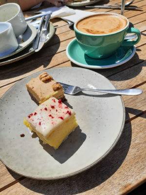
Because Thereza wanted to visit a café in Geraldine, we started our way towards Geraldine at 11 am. A good diversion, but the food was delicious and we definitely enjoyed the visit.
Breakfast at Barkers
Barker's Food Store & Eatery is suitable for a delicious coffee and breakfast, but also for a small visit to your own store where you can find various delicious things. We ourselves discovered and bought a pretty tasty tomato ketchup.
Breakfast in Geraldine
Afterwards we drove from Geraldine relaxed over the SH1 back to Christchurch.
All in all, we were on the road from Friday afternoon to Sunday afternoon. We covered a total of 480 kilometers. A good distance for 3 days which you can drive relaxed.
Questions, remarks or tips
Do you have a question about our trip or a comment? Then we would be happy to hear your comment. If you have a tip in the region for us, we would also be happy to hear your comment here under the articles. Have fun following our short road trip.
Ask us anything
We run this blog so you can have a great time in New Zealand. All the articles and videos are free for anyone.
If you want to ask an individual question about Newzealand, your working holiday or anything else around travelling New Zealand, then this is your chance.
Even it always looks like holiday, this website and the project is a fulltime business. So you can support us with any question if you'd like.
Simply click the button and ask us, in exchange for your answer you can give what you value our time.
If every visitor would support us with 1€ per year, our business would be up running for long times. Therefore we count on your support!
A big thank you from the depth of our hearts. Julian & the team of Project-Newzealand
Mt Cotton is on private land, the farm pretty much never grants access to it for members of the public and that’s because of ignorant people like you who don’t bother to ask permission. Please adjust this trip report to include that it is on private land so that others don’t do the same. All those other hills around it too that you mention you were looking at climbing next time are also on private land so don’t climb them unless you’ve been given permission by the farm.
Hi Griffyth,
first of all, thanks for your comment.
While you are correct after I did some research today. Back in the days when I did it (look at the date of the post), there was no signs, markers or anything else. Instead I found this hike via the signposts that were next to the road and highlighted the short hike to the summit.
I’m happy to include your notice about now being required to seek permission. Totally fair and no I don’t hike unless informed or gotten permission where required and signposted as such.
Cheers, Julian